We have been travelling in the region of SALTA with HOBO-Leuven-Belgium and had Gabriela as our local tourguide. Carlito was the driver of the tourbus and Jose was the driver of the Jeep with all our luggage. We were very delighted with their professional help and guidance. They were a terrific team together!
Sabine & Marc (Belgium).
Testimonios
You are congratulated for having recruited, trained and retained such valuable employees.
William (UK)
Testimonios
Joaquin: charming and very knowledgeable, excellent companion Lawrence & Emma (UK)
Estimated driving time: 6 hs. | Distance: 320 km / 199 ml paved road. 70 km / 43 ml gravel road. | Altitude: Highest point 4.300 m./ 14.108 f. Purmamarca 2.192 m. / 7.192 f. | Meals Included: Lunch.
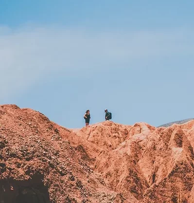
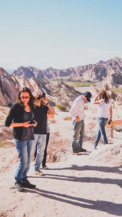
The Humahuaca Gorge is a large valley that ends at the border with Bolivia and it is located in the province of Jujuy in the far north of Argentina. It is quite a young Valley, given that its formation dates a million years old. The Gorge is famous for its colourful mountains, its geological formations and its historical villages.
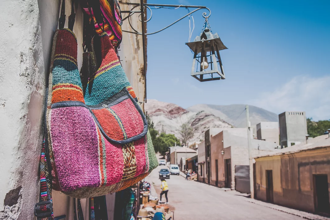
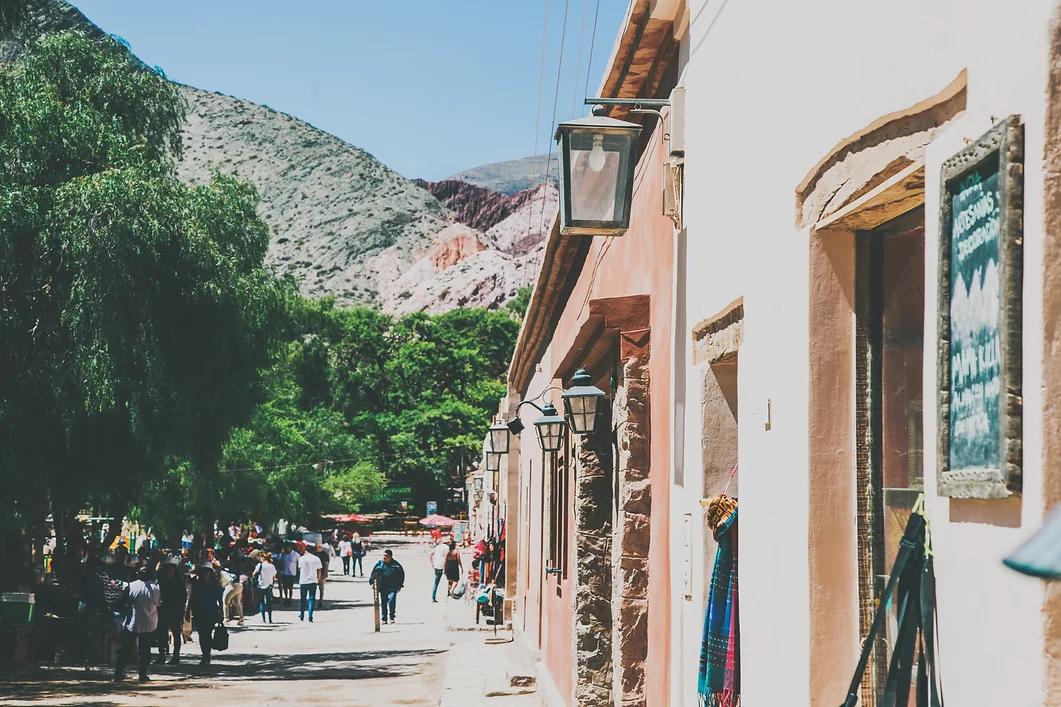
During our visit we will have the best place to feel the real atmosphere of this part of Argentina: the Humahuaca Market, a walk in the Colorado’s Gorge, a sacred garden of Cardones at 3200 meters, the impressive Serranías del Hornocal and the Pucara of Tilcara – a pre-Inca fortress. We will also visit the villages of Tilcara, Humahuaca and Purmamarca with their typical artisanal markets.
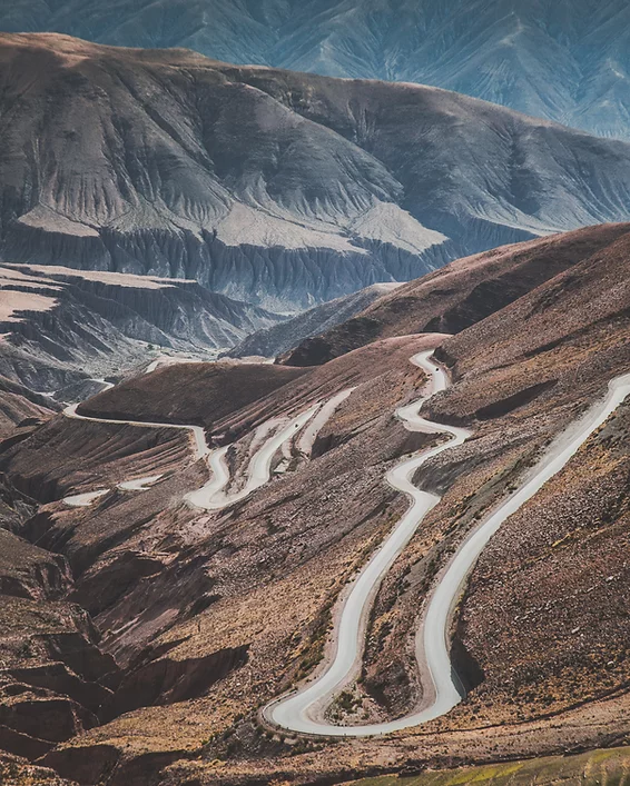
Purmamarca | Cuesta de Lipan | Salinas Grandes | Susques | Paso de Jama | San Pedro de Atacama
Estimated driving time: 6 hs. | Distance: 430 km / 267 ml paved road. | Altitude: Highest point 4.700 m./15.420 f. San Pedro de Atacama 2.475 m. / 8.120 f. | Meals Included: Breakfast and lunch.
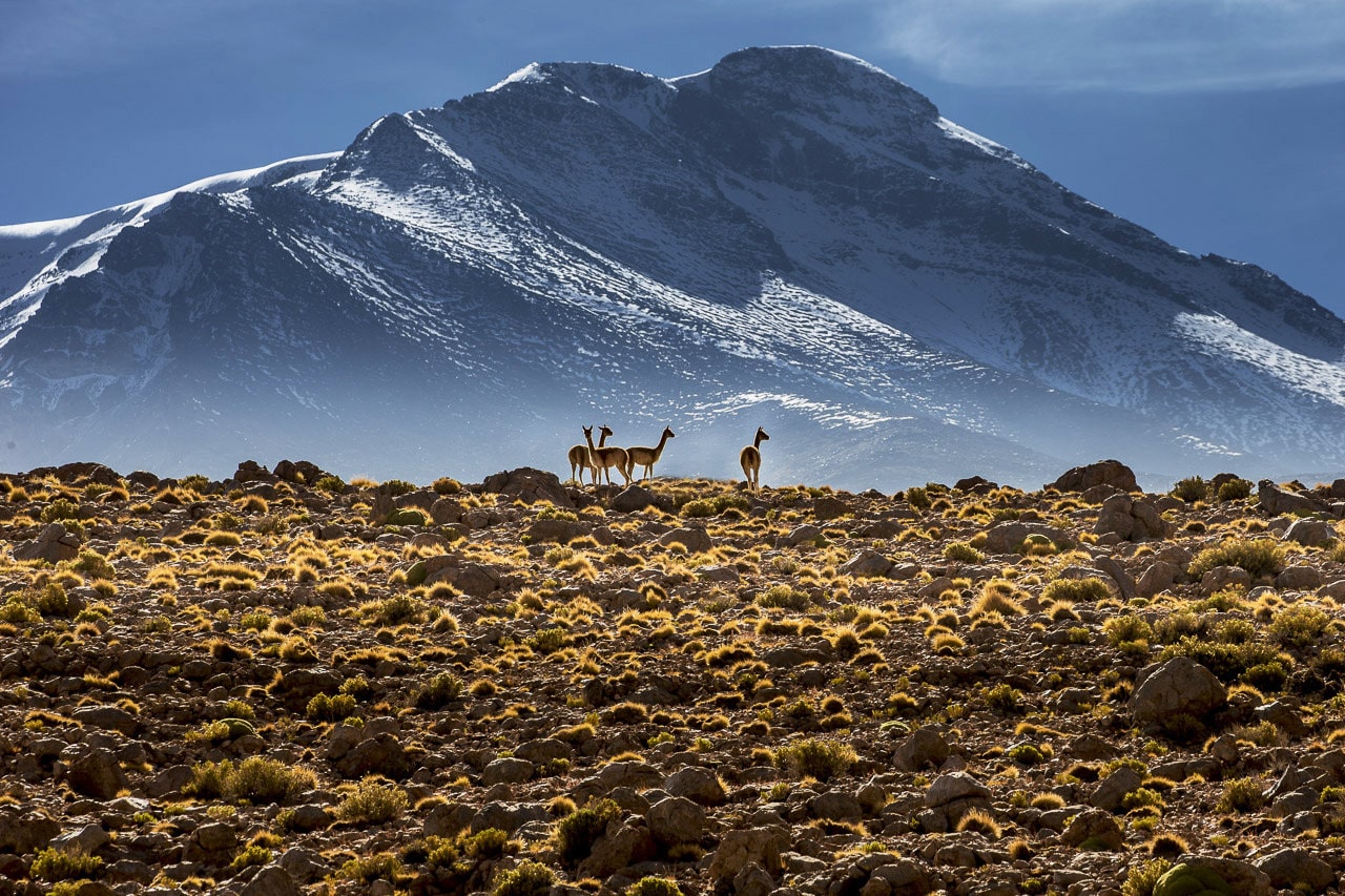
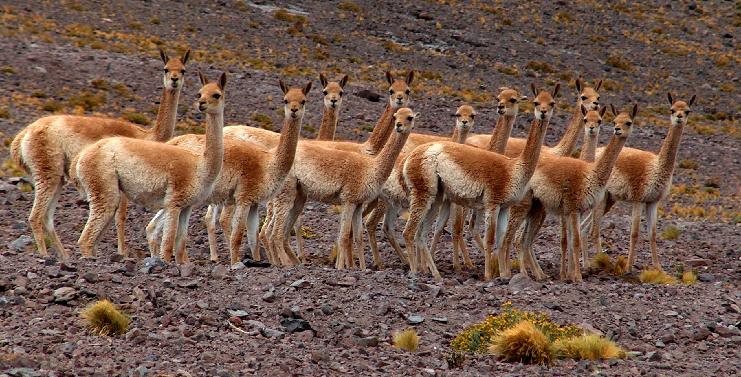
A fantastic drive on a perfectly paved road will guide us across the Andes, through dry salted lakes, volcanoes, groups of wild vicunas, and the infinity of the Puna Plateau. Visit to the Salinas Grandes, a salt mirror covering more than 30,000 acres and the old capital of the Puna, Susques and its 1598-built Church.
We will cross the border to Chile at Jama Pass. At sunset, we will arrive at San Pedro de Atacama, after a 50 km straight downhill with view over the Atacama Desert and the perfect cone-shaped Licancabur Volcano, the real Master of the Region.
Note: Since we operate many of our tours in remote high altitude areas itineraries may be subject to change due to weather and road conditions or any other conditions of an operational nature throughout the year (such as: snow fall, heavy rain, strong winds, etc.), especially in places higher than 4000 meters. As such we reserve the right to alter, and/or cancel any section and/or parts of the itinerary which may result from conditions beyond our control.
San Pedro de Atacama | Full Day Tour to Geysers del Tatio | Sunset in Valle de la Luna| San Pedro de Atacama
Estimated driving time: 5 hs. | Distance: 30 km / 18 ml paved road. 190 km / 118 ml gravel road. | Altitude: | Meals Included: Breakfast and lunch.
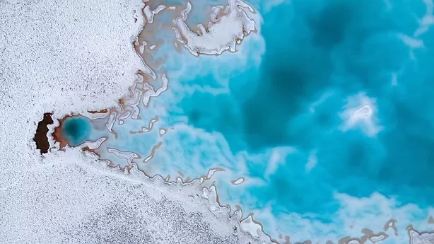
A very early departure will take us to the Geyser del Tatio. El Tatio Geyser Field (locally known as Los Geysers del Tatio) is located within the Andes Mountains of northern Chile at 4,200 meters. With over 80 active geysers, El Tatio is the largest geyser field in the southern hemisphere and the third largest field in the world. There, you will be participating in one of the most astonishing phenomenons produced by nature and see contrasting colours produced by the steam columns in the highest geothermal field in the world. You will walk across the tracks over the geothermal field.
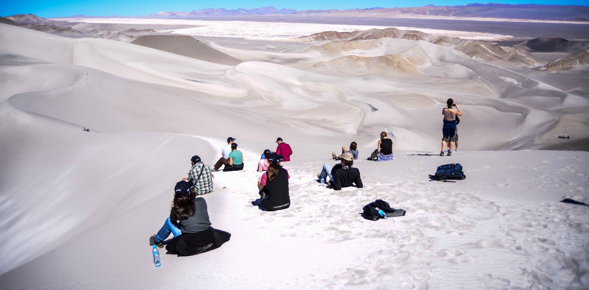
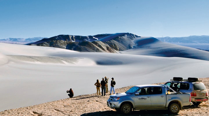
Return to San Pedro de Atacama for a rest and in the afternoon we will see the sunset on the mountains of the Andes and on the Luna Valley on the outskirts of the village. Valle de la Luna is an area of stone and sand geological formations. It was declared a Natural Sanctuary and is also part of Los Flamencos Reserve, a protected zone. A place of desolation where the wind has sculpted mounts and ravines of salt, clay and gypsum. There is no life in this valley and no humidity; it is the most inhospitable place on the planet. We will have time to visit the Tres Marias (Three Marias), rocky mounds formed by erosion, la Mina de Sal Victoria (mine), where you can take a short walk of 15-20mins, and also take a walk around the Valle de la Luna, and climb the Duna Mayor (dune of 2600m), from where you can see the sunset. For those who aren’t keen on walking, instead of climbing the dune, there is another option of leaving the alle de la Luna and travelling in vehicle to the Mirador del Coyote (Viewpoint), also part of the reserve from which you can also see the sunset.
San Pedro de Atacama | Lagunas Miscanti Miniques | Paso de Sico | Pocitos | Desierto del Laberinto | Tolar Grande
Estimated driving time: 6/7 hs. | Distance: 110 km / 68 ml paved road. 250 km / 155 ml gravel road. | Altitude: Highest point 4.600 m./15.092 f. Tolar Grande 3.500 m. / 11.483 f. | Meals Included: Breakfast, lunch and diner.
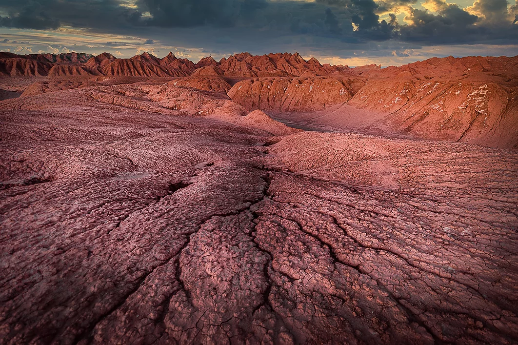
Today will probably be one of the most intense days of the whole Trip. Following one of the ancient routes made by llama’s caravans trading goods between the Oases of the Puna, we’ll drive to Sico Pass. Miscanti & Miniques lagoons offer one of the most famous scenes, with dark blue water, cobalt sky, flamingos and sacred Volcanoes. Back in the Argentine Plateau, the landscape will completely change. The labyrinth Desert, a fossil dunes desert, made by clay and gypsum crystals, is the only maritime sediment deposit of the Puna. This area is actually studied for its similarities to other planets physic characteristic (Planetary Geology). Arrival to the tiny village of Tolar Grande, one of the most remote places on earth.
Note: Since we operate many of our tours in remote high altitude areas itineraries may be subject to change due to weather and road conditions or any other conditions of an operational nature throughout the year (such as: snow fall, heavy rain, strong winds, etc.), especially in places higher than 4000 meters. As such we reserve the right to alter, and/or cancel any section and/or parts of the itinerary which may result from conditions beyond our control.
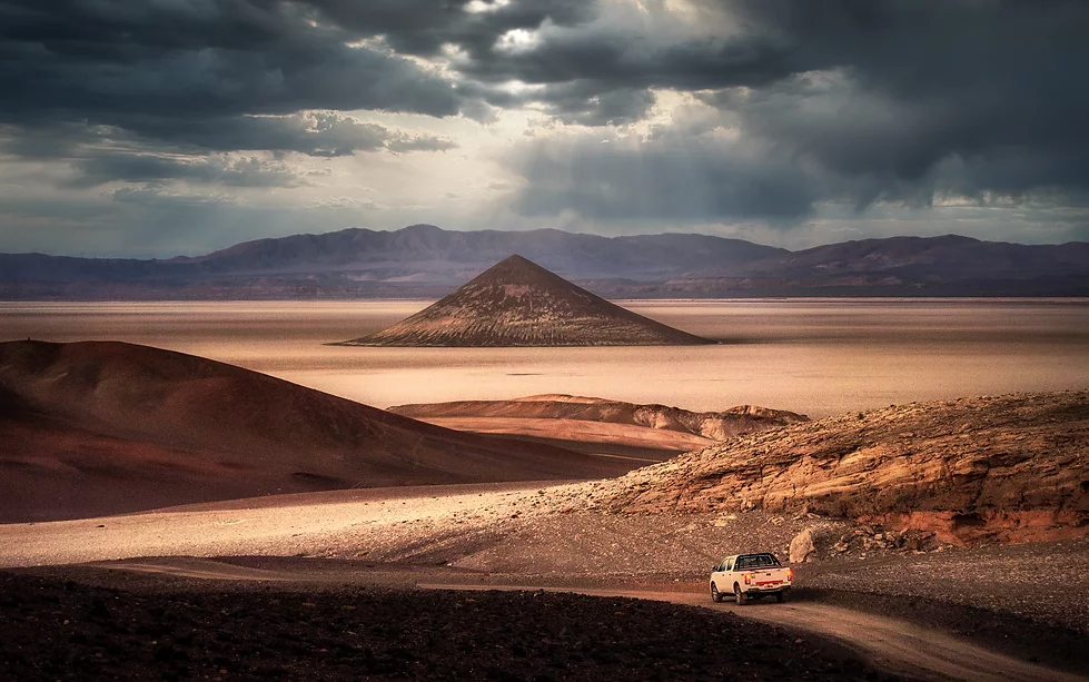
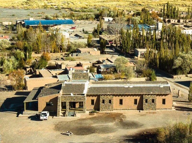
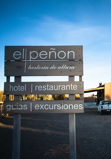
Tolar Grande | Cono de Arita | Oasis de Antofallita y Antofalla | Antofagasta de la Sierra | El Peñón
Estimated driving time: 7 hs. | Distance: 340 km / 211 ml earth track and salt road. | Altitude: Highest point 3.457 m. / 11.338 f. Molinos 2.020 m. / 6.625 f. | Meals Included: Breakfast, lunch and diner.
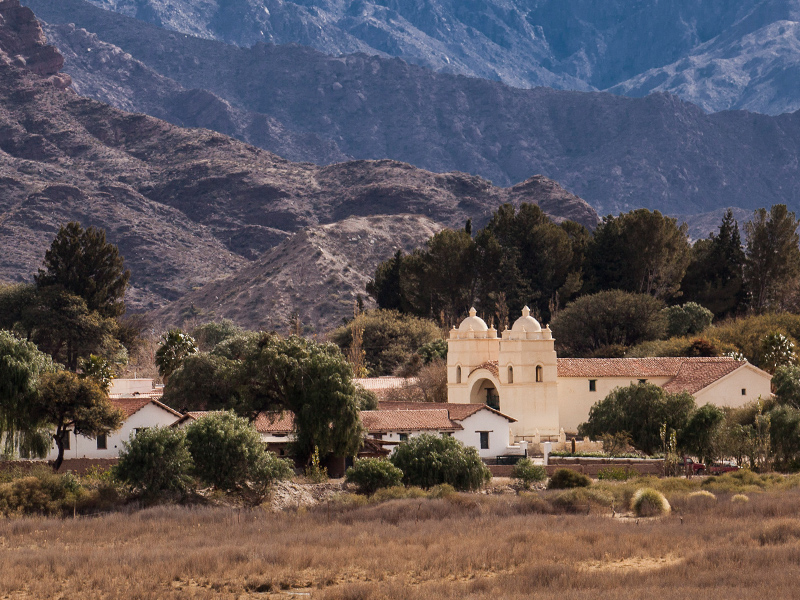
The crossing of the Arizaro Salted dry lake resembles the ancient journey of the Arrieros (shepherds guiding caravans of animals to Chile). Arizaro meaning Vultures Cemetery, comes from a period when many animals (cows and horses) perished during the crossing of the salt flat. Antofalla is an important and spectacular example of a Puna Oasis; in the middle of a high altitude desert there is a green valley, thanks to a natural pure water spring, full of Poplar, Molle and Willow trees. Antofalla, together with Antofagasta and Santa Rosa, were important stations for Llama caravans connecting this part of the Andes with the Oasis of Atacama.
The Oasis is located just at the border of the longest salt flat in the world, among red mountains and lava strips. Antofalla is still inhabited by a tiny community of 60 people, they are all shepherds. We will stop for lunch, and then travel across the colored mirror of the salt lake. Above 4.200 meters with wide views over the Antofalla Volcano (6.400 mts) lays a kind of green field (Vega Colorada) home of llamas, suris (Andean ostrich), wild donkeys and vicuñas.
The valley of Calalaste, just a few kilometers away from Vega Colorada is the best spot to find wild camelids. Antofagasta de la Sierra, was the biggest Oasis on the path connecting this side of the Andes with the Oasis of San Pedro de Atacama (Chile), it is a big village with more than 2.000 people who maintain their ancient traditions and culture. The name Antofagasta means “place where the sun shines” and it is surrounded by uncountable Volcanic Peaks
El Peñón | Volcán y Laguna Carachi Pampa | Campo de Piedra Pómez | Dunas Blancas | El Peñón
Estimated driving time 8 hs. | Distance: 150 km / 93 ml of earth, gravel and salt tracks. | Altitude: Highest point 4.200 m./ 13.780 f. El Peñón 3.400 m. / 11.155 f. | Meals Included: Breakfast, lunch and diner.
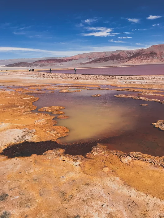
Our adventure starts today at the edge of Campo de Piedra Pómez, as we reach the Carachi Pampa basin, in its margins there is a Volcano of the same name, surrounded by black lava fields and a lagoon, where the Andean flamingo, and the James' (or puna) flamingo can be found. During dry season a small salt lake is formed around the lagoon. Later, our journey will continue into the Natural Reserve Campo de Piedra Pómez, a strange and stunning landscape carved into the rock that gives rise to its name: The Pumice.
Of purely igneous origin, it was produced from a massive explosion of the volcanic stratum, this explosion was so powerful that if one could have seen it, it would be similar to the mushroom cloud produced by a nuclear bomb. This cloud has spread the ashes and debris in large areas and in different directions, which crystallized by the effects of the temperature giving shape to these wonderful rocks with special features and with plenty of holes produced by the escape of gases during the chilling stage.
This degassing phenomenon made the rock very easy to carve by the winds of the Puna, arid and harsh winds that move freely through the region, becoming the best and most prominent Andean rock sculptors. This strange landscape of white labyrinths and climbing sand dunes is located a few miles to the west, on a track where the path continues through some sand that we could describe as the dream of the explorer, an overlanding adventure. Return to the Hotel, just on time to enjoy stunning sunset views from the village.
El Peñón | Antofagasta de la Sierra | Campo Las Tobas | Real Grande | Laguna Diamante | Cerro Galán Caldera | Laguna Grande | El Peñón (Season: from October to April)
Estimated driving time: 8 hs. | Distance: 250 km / 155 ml | Altitude: Highest point 5.000 m./ 16.404 feet. El Peñón 3.400 m. / 11.155 feet. | Meals Included: Breakfast, lunch and diner.
With an early start, we will drive in direction to Antofagasta de la Sierra as we enter the región of Real Grande (4050 meters), where traces of the first settlements of the Puna can be found in ancient petroglyphs, dated 10000 B.P. and entrance point to Cerro Galán Caldera from the Northwest. Cerro Galán, is one the world;s largest volcanic calderas and greatest of the Andes Mountains, its dimensions are 34 km from north to south and 24 km from east to west, and it is the result of an extreme plinian eruption that occurred 2.2 million years ago.
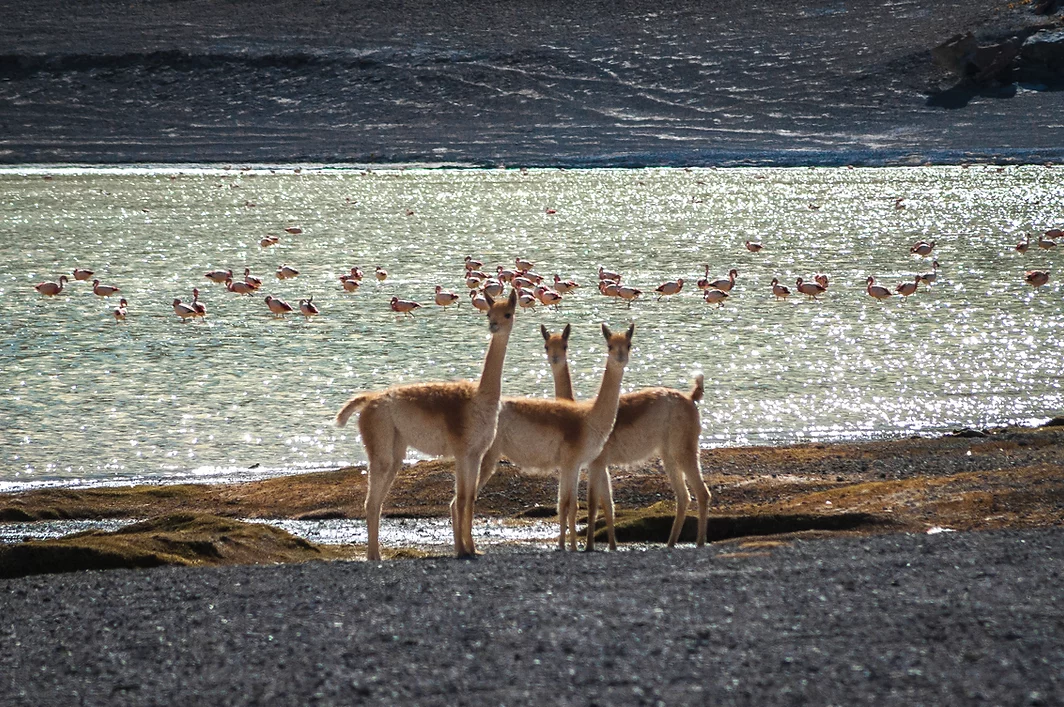
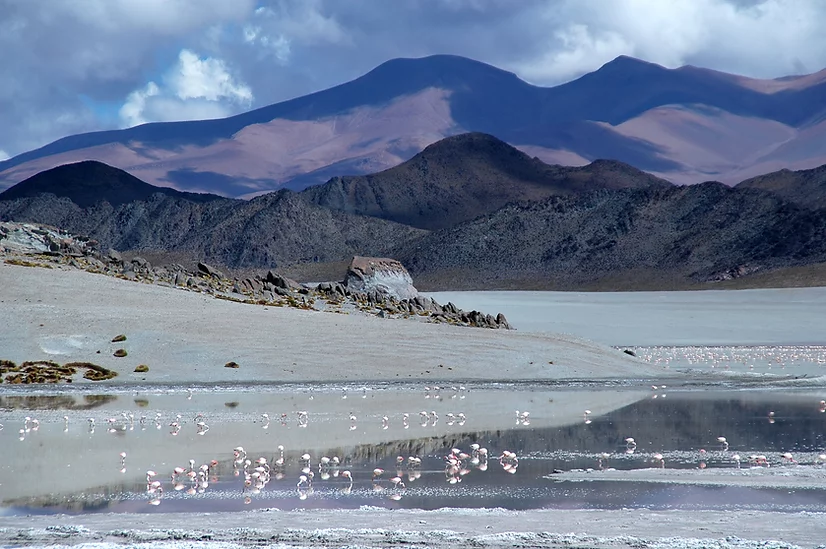
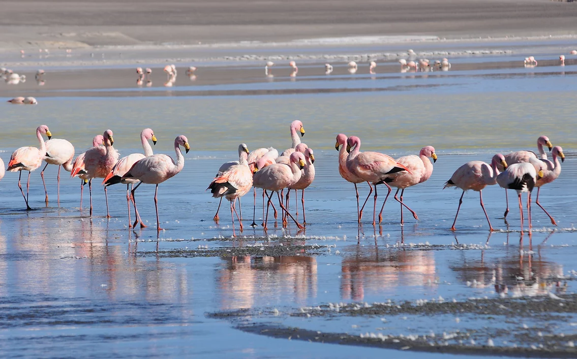
Its identification as a volcanic caldera was performed using satellite photographs, since its elliptical shape is too large to be able to appreciated from the ground. Its walls reach 5,000 meters of altitude and the central peak 5,912 meters, while its floor is at 4,500 meters of altitude. The Caldera contains a lake in its south western corner, known as Laguna Diamante, which is home to flamingos and ducks, protected from the wind by the walls, in this extremely harsch environment. Our path will lead us to another high altitude Andean lake, known as Laguna Grande Reserve, a saline lake that sits at an altitude of 4150 meters.
During winter, the water freezes completely, but when spring arrives, it becomes the largest gathering center of the Puna flamingo birds, also called Small Parina (Phoenicpterus jamesi), with more than 19,000 birds (25% of the known total population). It is also a place for summer congregation for the Andean flamingo (Phoenicpterus andinus) and it is a common nesting site of Southern flamenco (Phoenicopterus chilensis). We will drive to El Peñón with the perfect warm light of sunset.
El Peñón | Laguna Grande | Cerro Galán Caldera | Laguna Diamante | El Peñón (Season: from May to September)
Estimated driving time: 8 hs. | Distance: 170 km / 105 ml dirt and gravel road. | Altitude: Highest point 4.000 m./13.123 f. Cafayate 1.683 m. / 5.522 f. / 11.155 feet. | Meals Included: Breakfast, lunch and diner.
Our path will lead us first, to a high altitude Andean lake, known as Laguna Grande Reserve, a saline lake that sits at an altitude of 4150 meters. During winter, the water freezes completely, but when spring arrives, it becomes the largest gathering center of the Puna flamingo birds, also called Small Parina (Phoenicpterus jamesi), with more than 19,000 birds (25% of the known total population).
It is also a place for summer congregation for the Andean flamingo (Phoenicpterus andinus) and it is a common nesting site of Southern flamenco Phoenicopterus chilensis). Cerro Galán, is one the world's largest volcanic calderas and greatest of the Andes Mountains, its dimensions are 34 km from north to south and 24 km from east to west, and it is the result of an extreme plinian eruption that occurred 2.2 million years ago.
Its identification as a volcanic caldera was performed using satellite photographs, since its elliptical shape is too large to be able to appreciated from the ground. Its walls reach 5,000 meters of altitude and the central peak 5,912 meters, while its floor is at 4,500 meters of altitude. The Caldera contains a lake in its south western corner, known as Laguna Diamante, which is home to flamingos and ducks, protected from the wind by the walls, in this extremely harsch environment. We will drive back to El Peñón with the perfect warm light of sunset.
El Peñón | Hualfin | Santa María | Quilmes | Cafayate
Estimated driving time: 5 hs. | Distance: 250 km / 155 ml paved road. 50 km / 31 ml gravel road.| Altitude: Highest point 4.000 m./13.123 f. Cafayate 1.683 m. / 5.522 f. | Meals Included: Breakfast and lunch.
After days of intense travel on the High Desert Plateau, the North West still has plenty of surprises. The paved road from El Peñón to meet Route 40 is a 150 km long yellow field of Paja Brava, white lagoons and a deserted narrow canyon filled with rich vegetation.
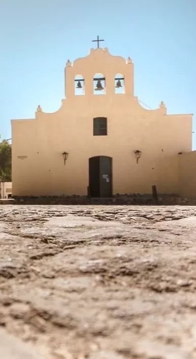
We will visit the Quilmes Ruins, probably the most interesting Pre Inca Archeological site with a dramatic story that gave an end to this ancient population. Arrival and overnight at the pleasant village of Cafayate and its green vineyards.
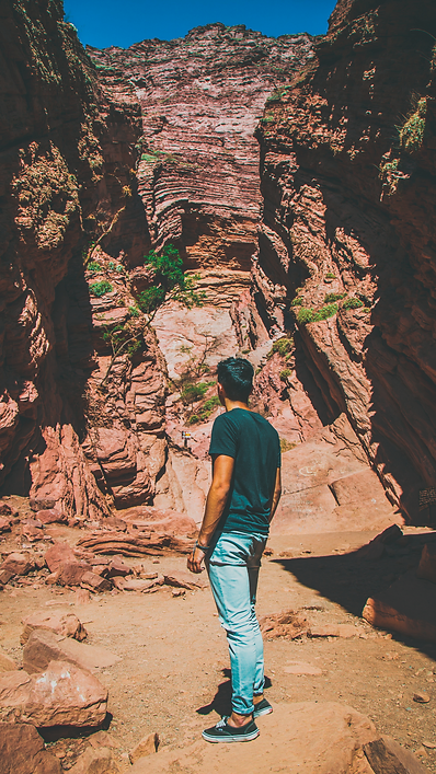
Cafayate | Quebrada de las Conchas | Quebrada de las Flechas | Molinos
Estimated driving time: 5 hs. | Distance: 100 km / 62 ml paved road. 90 km / 56 ml gravel road. | Altitude: Highest point 2.300 m./7.546 f. Molinos 2.020 m. / 6.627 f. | Meals Included: Breakfast and lunch.
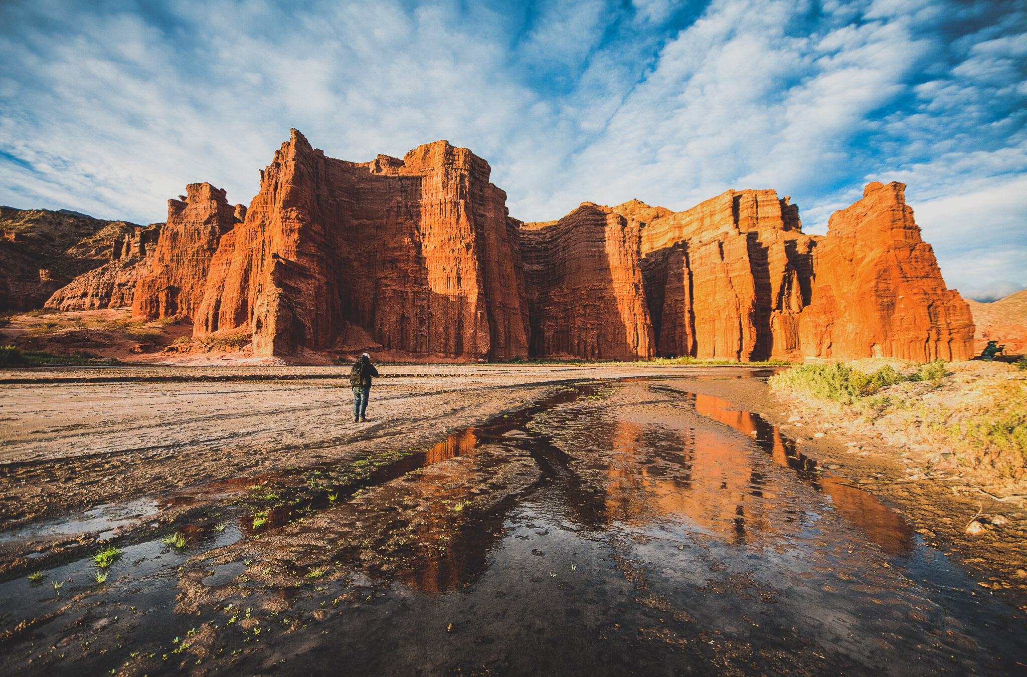
Cafayate will be a perfect place to visit a winery since it is the capital of the Northern wines, most famous for its “Torrontés” variety of white wine. We’ll visit the Quebrada de las Conchas gorge, 55 km of scenic sediment rocks formations dated from 40 to a hundred millions years, with geological formations as the Yacoraite or the Pirguas with great importance. The Ruta 40 is one of the most famous and longest roads in the world.
The route between Cafayate and La Paya passes through desert scenarios, small ranches of local campesinos, vineyards and giant colored mountains. The Quebrada de las Flechas is a desert of Quartz ashes and rocks covered by the mud of an ancient lake, the result of 500 million years of geological history.
Qebrada de las conchas
Cafayate, Salta
Quebrada de las conchas, A beautiful scene of stone walls and reflections in the water.
sunset over mountains and a rainbow across the landscape
Molinos | Cachi | Los Cardones National Park | Cuesta del Obispo
Estimated driving time: 4 hs. | Distance: 122 km / 76 ml paved road. 81 km / 50 gravel road. | Altitude: Highest point 3.457 / 11.342 f. Salta 1.200 m. / 3.937 f. | Meals Included: Breakfast and lunch.
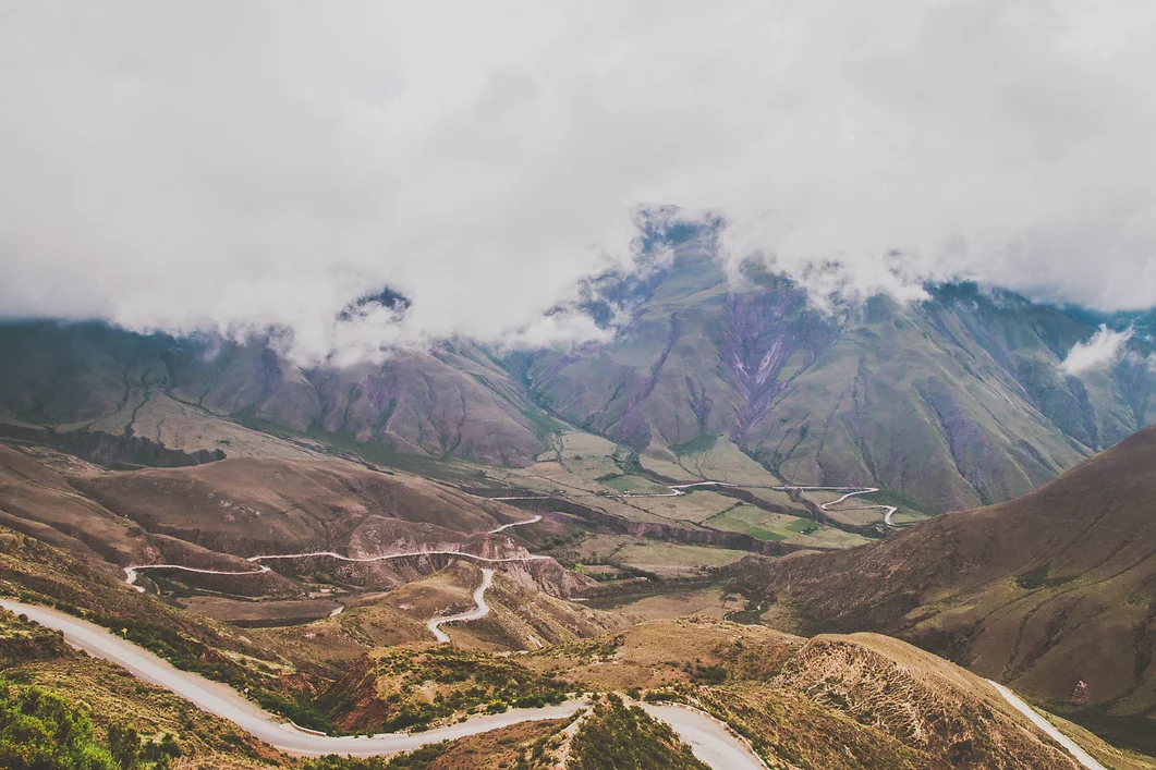
The road from Molinos to Salta is one of the most scenic drives in NW Argentina. We’ll travel through four ifferent eco systems; from the green Yungas Forrest to a semi-deserted dry valley. 50 km will take us from Piedra del Molino Pass at 3.457 meters down to Salta’s Valle de Lerma at 1.200 meters: condors flying in the dark blue sky, guanacos and wild donkeys between thousands of Cardones – the local protected species of giant cactus. Time to stroll around and have a short walk in a small colored desert, rarely visited in the Cardones National Park.